
I should probably start, for those who have not read or heard about the Challenge before, with an explanation of what it's all about.
The Great Outdoors Challenge is an annual event largely sponsored by The Great Outdoors Magazine and one or two other outdoor companies. Each September, over four hundred folk apply to take part and a draw for places is made around the end of October. Three hundred and fifty or so folk gain a place and an unlucky few will be placed on the Stand By List to fill the boots of those that have/choose to withdraw before the end of November. Each Challenger or group (of up to four) submits their own route, starting at one of the fourteen start points on the west coast, making their way unsupported across Scotland to finish anywhere on the east coast between Fraserburgh and Arbroath, then catch the train, bus or walk to Montrose to sign back in. The start points are Torridon, Strathcarron, Plockton, Dornie, Shiel Bridge, Glenelg, Mallaig, Morar, Lochailort, Acharacle, Oban, Ardrishaig, Kilchoan and Portavadie.
Four phone calls must be planned and made to Challenge Control to check up on progress, phone calls must also be made if major route changes occur, or if someone is unlucky enough to have to retire from the event (horrid, horrid phone call to make...) There are few rules, no running (why would you?!), no dogs, no unofficial crossings and no accompanying walkers to do an entire crossing (friends and family can join you for few days)
I had originally planned a completely different route across Scotland for this year, with an entirely different objective, but when I got my place on this year's Challenge, I realised it would be a good idea to start somewhere I could reach on the Friday morning and set off without having to stay over the night before. Out of the four start points that this is easier to achieve, I settled on Dornie.
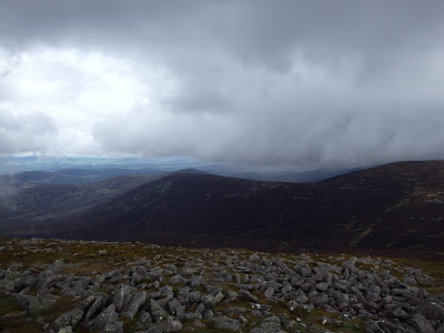
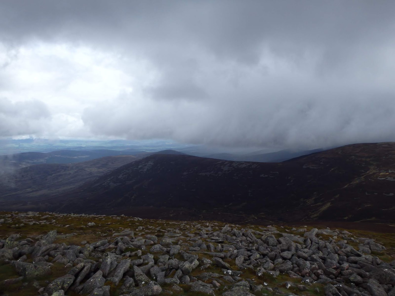
Day 1 Dornie to Allt-Coire-lochain
Planned 20 km 830 m ascent
Actual 23.6 km 943 m
NH 028 253
 The obligatory toe dip

 Loch Long


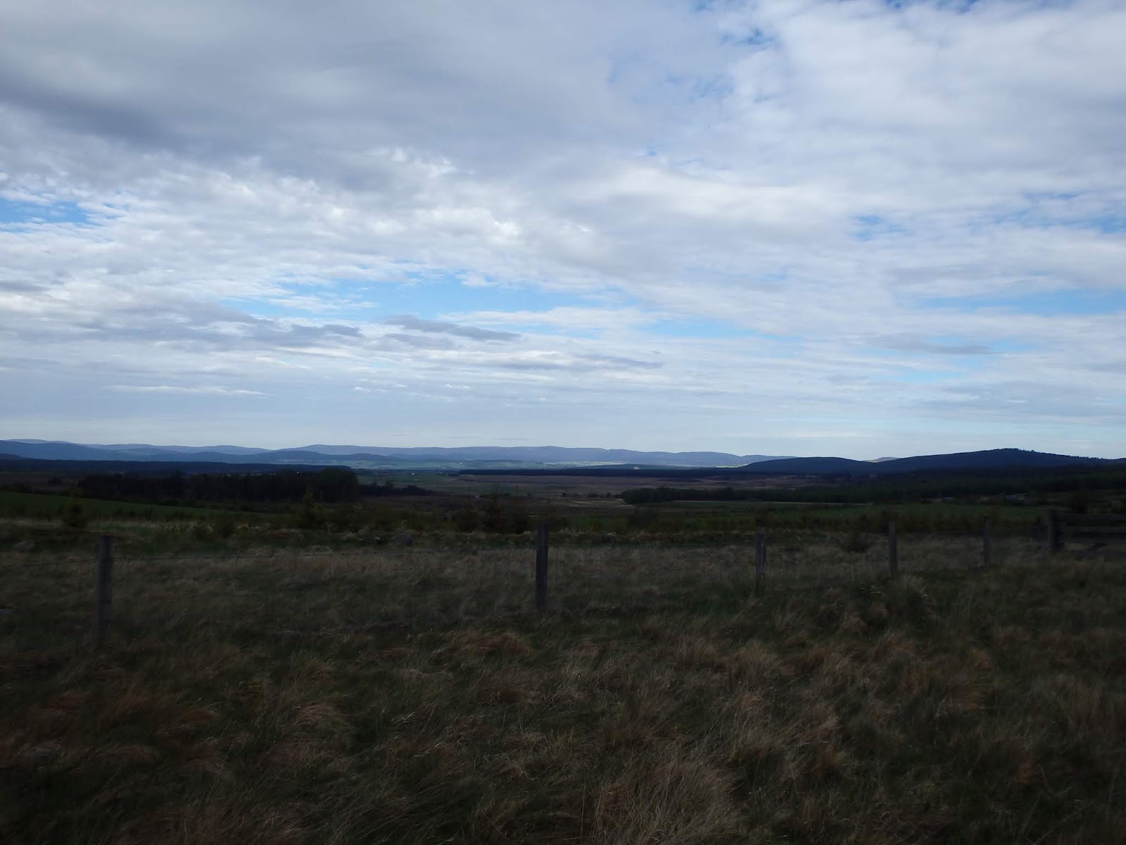
 Looking west


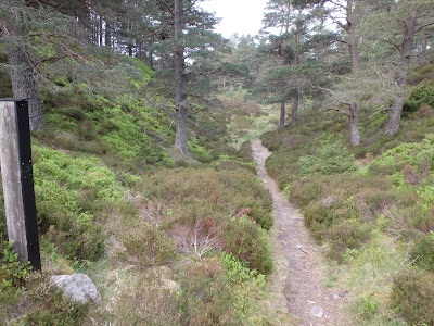
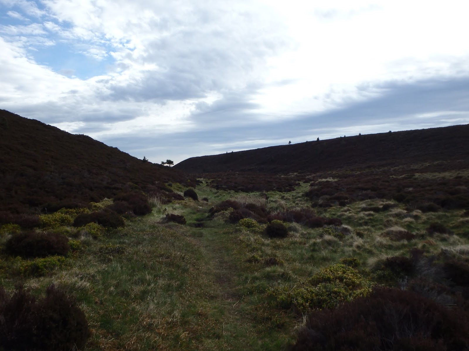
 There was a path somewhere
 Loch na Leitreach

NH 028 253
David dropped me off at the station at 07:30 on Friday morning to catch the train. There was a minor delay before arriving at Inverness station and then walking to the bus station. I had thought there may be one or two Challengers around, but in the end I only identified two, Peter Aylmer, who was starting at Shiel Bridge and Nicole Morschett, who was starting at Dornie like me.
The bus passed through the countryside as we sat chatting and catching up on news from the last year, soon we said goodbye to Peter (who should probably have stayed on the bus a short while longer to alight at the Kintail Lodge Hotel) and then we were alighting the bus ourselves by Dornie Castle. It became apparent at this point that two other Challengers had been on the bus after all, Anna-Maria Wedlich and Minna Lumirae, who introduced themselves and we chatted briefly before they left to visit the castle and we set off to find the hotel to sign out.
There was a small amount of faffing at the hotel, including a comfort break, a map faff and a hat faff, but we were eventually on our way at around 11:10, setting off together NE along Loch Long, then E along River Glennan. This is a very pleasant wander most of the way and we chatted as we went and heard our first cuckoo of the trip. Further along the glen, we separated a little as the track became a single file path and I walked a little ahead of Nicole, wending my way through the rocks and muddy patches until we reached a tricky steep slope we had to negotiate. Neither of us were fond of this bit.


Still, we continued up hill as the glen steepened and narrowed towards the top, then we crossed through a gate and started making our way downhill. This was a little time consuming as for most of the way the path is vague, but made it to the bottom without breaking any limbs and through the gate before the picnic bench I had promised Nicole hove in to view and we stopped for lunch. This was of course where we felt the first rain drops of the day, predictably, but we ignored them for a while before eventually conceding to don waterproofs and set off again.
Initially the path continued along the south of River Elchaig before we crossed a bridge and had to negotiate cattle on the road. Neither of us are fond. Through a gate and we were safe again and soon at my first turn off, first because I soon met a chap on the Cape Wrath Trail coming down from the Falls of Glomach who expressed great concern at me continuing alone up the path he had just come down and not enjoyed in the slightest. I should perhaps not allowed his worries to sway my decision, but I was not keen in the first place so quickly decided to turn around and walk with him to the next bridge at Carnach and the second falls, along the Allt Coire Easaich.
I can't say these falls filled me with joy either, I knew the path by the falls had suffered a significant landslip at some time, but had no idea how bad it was. There was a detour route of around 2.5 km and 300 m ascent, which didn't appeal either, but whilst I dithered I noticed a little that along the crags there was a small notch, with a zig zag of grass leading up to it. I could make that, possibly, I thought. I gave it a go. It took me about forty minutes to negotiate the steep climb, find a way through the notch, over a more gentle slope behind and drop down onto an unexpected ATV track that was heading in the right direction, so not really any different to the time the detour would have taken me. My new track soon met the path from the falls and I continued along happily until I spied a tent by the track ahead. As I approached, a voice came from the tent, "Who's that?"
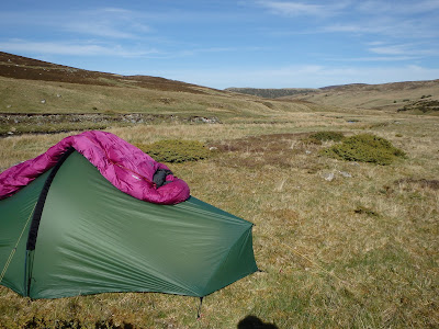
The occupier turned out to be fellow Challenger, Kirsten Paterson, attending to her feet before tucking up for the night. After a brief chat I continued on my way to my proposed camp. I was most put out to find a (lovely) french couple, non-Challengers, pitched at my spot. I had waded the Allt Coire-lochain so continued along the track, only to realise I was walking away from a water source and it would be another couple before perhaps finding another, so back I went. I tried to find a spot on the south side of the river, but eventually had to cross back again to find more promising ground. A spot picked, I pitched, collected water and visited the facilities before getting into my tent just as it started to rain. It wasn't too long before the chores were done, dinner eaten and my diary written and I was settling down with Sir Ian McKellen for my first wild camp of this Challenge, only my second ever solo wild camp. Actually, quite a good first day!


From my high perch
Day 2 Allt-Coire-lochain to Athnamulloch
Planned 16 km 220 m ascent
Actual 26.1 km 592 m ascent
NH 200 233
 Breakfast
NH 200 233


Bed shaped

It had been cold in the night, I was aware of it, but had been warm enough in my super dooper sleeping bag with an extra layer of clothes on, just to be sure. In the morning, the rain that had been falling as I settled down for the night had frozen and the tent was covered in thick ice. It would take a while for the sun to rise high enough over the mountain ridge behind me to warm my tent so I didn't rush to have breakfast and pack. I was ready to walk by 08:45 and this morning managed to cross back over the river without having to force my feet into my frozen fording shoes. Lucky. I made my way back to the track and continued S along Gleann Gaorsaic towards Gleann Gniomhaidh. and Alltbeithe Hostel. I was expecting Gleann Gaorsaic to be really wet, but in fact it was no wetter than any other glen I've walked through and I quite enjoyed myself as I wandered along the ATV track until I lost it somewhere before entering the next glen. I stopped part way along to have a look at a potential hot spot. I'd not tightened the laces of my right boot enough and my foot was sliding sideways slightly on the rough ground. I applied a preventative Compeed plaster, just in case, tightened my laces, then continued on my way. I stopped and chatted with a Corbett bagger as I gained the path to Alltbeithe, we discussed the hill she was heading for, Sgurr Gaorsaic, having taken out her map and compass and realised she was looking at the wrong one, and decided she'd be better following the path a little longer to avoid some crags before just heading straight up.
After just over four hours, I made the hostel and went inside to enjoy a rest with tea and freshly made scones. Bliss. Whilst enjoying my break, I was joined by another Challenger, Mike Turner. It's always lovely making new friends and I thoroughly enjoyed Mike's company for the afternoon. Ed Hyatt also arrived at the hostel just as we were leaving and we chatted briefly before Mike and I left.

View from my tent towards Stuc Mor

We continued along Glenaffric, chatting amiably, until we reached Athnamulloch, my proposed stop for the night, at around 16:00. It felt too early to stop and felt awkward to stop there now Trees for Life have done up their bothy, so we decided to continue walking to find a more suitable stop. I was fairly sure we would walk all the way to the Glen Affric car park as pitches are few and far between and that's what we did, luckily for Nicole who was apparently a couple of hours behind us we found out later, having come from Iron Lodge, and she was able to stop where we'd decided the patch of flat ground was too small for two tents and the water wasn't good enough. We found a few Challengers pitched below the car park and several other campers near the toilets which was where we found space to pitch. Everyone was friendly and we had a pleasant evening before retiring to our tents. Another lovey day, what a good start to the Challenge!


Towards Athnamulloch
Day 3 Athnamulloch to Cannich
Planned 27 km 590 m ascent
Actual 21.2 km 312 m ascent
NH 341 314


NH 341 314

Again, another cold night and we woke to iced tents. I chased the sun along a grassy bank to lie my sleeping bag in the sun and dry the damp patches from lying against my tent inner which was also damp. When I came to pack it my tent was not quite dry, but I was none to worried as I knew I would be able to dry it once I arrived in Cannich. Nicole arrived to use the facilities and we all left together about 08:48. Mike had to take a break shortly after as we'd set off to fast for his knee, but Nicole and I took a long break at the junction for Tomich which allowed him to catch up with us, and Byron Davies too. Byron set off ahead of us, we sauntered behind, but were just in time to see him take a wrong path before we'd reached Tomich. He was too far ahead for us to be able to get his attention, which was a shame.

Fancy fountain as we left Tomich
We had lunch at a handy picnic bench in Tomich, then marched on to make sure we got to Cannich in good time. We arrived at 15:10, absolutely delighted with the time we'd made, and quickly got settled in and on with the chores. I had opted to book a pod, having planned for rain for the first two days, and despite this having been a warm dry day, the first of several as it turned out, I was still chuffed to have done so. It was nice to have warm, dry space I was able to spread out and stand up in. There were Challengers aplenty on site, including David Pickles, Byron, Bernie, Pieman and son. I showered and made use of the laundry and outside line, before going for dinner with Nicole at The Slaters Arms, always an interesting establishment. Their customer service can be a little lacking, but the waitress was lovely even when under duress and the food was okay. After we had finished, we saw Laura walking in to town and waved, she waved back and made her way to join us. Nicole went for drinks and we all had a good catch up before heading back to the campsite. Nicole and I transferred our nearly dry washing from the line into the drying room, then both retired for the night.
I love Sir Ian.

Day 4 Cannich to Ault-na-Goire
Planned 27 km 730 m ascent
Actual 33.2 km 745 m ascent (including the boat across the loch)
NH 544 230
 Doesn't make the trail attractive

 The sun shines out of Mick's arse at Ault-na-Goire...
NH 544 230
I have no idea how the weather was during the night, I was warm and dry in my pod with my new friend, Arnie the Arachnid. We reached an agreement by which if he left me alone, he would not meet a sticky end. I don't think I slept brilliantly (Note to self, spread sleeping mats in a pod, don't teeter on top of one...) I was super organised and on my way by 07:50, setting a steady pace to climb the hill out of Cannich. I made good time to reach the turn off for the Corrimony Chambered Cairn and to continue the Affric Kintail Way off road to Lochletter.
I met another Challenger having a break, first timer Adrian Wain, we chatted briefly and then I conitinued. I soon caught up with three more first timers, Michael Bowman, Joan Laurion and Ruth Bowman from America. They were very friendly and chatty, Michael was not feeling great as he had the start of a cold, so when they paused I continued as I wanted to make the picnic benches at Lochletter for my break. I reached the benches at 10:50 so stopped for elevenses, finding Jim Davidson and Bernie already in residence. We were joined by Alan Kay and Adrian, but the Americans pushed on after saying hello again. Everyone chose to continue on the Way, except for me. I know there is a killer hill and on this hot day, with a final killer hill before Ault-na-Goire later in the day, I opted for a spot of easy, downhill road-walking. I did not regret my decision, others might have regretted theirs...


I arrived in Drumnadrochit at around 12:50 and immediately made contact with Mick and Gayle so we could meet for lunch. They looked after my pack whilst I nipped to the village stores to resupply, then we moved to The Fiddlers to have lunch. The pub made this far more complicated than it need to have been, but we ate our chosen meals outside and we had some nice cold drinks and I may also have had a tub of ice cream. There were Challengers in town and most conversations consisted of questions about shopping and when we were all catching the boat. Mick and Gayle were hoping to catch the 16:00 whilst I was due on the 17:00. I opted to walk down with them as I had nothing better to do, and as it happened Gordon had a spare seat and I snapped it up in a heart beat. Again, many Challengers, not many names are coming to mind. The boat trip was smooth and swift over calm waters, we clambered out onto the shifting rocks of the pier at Inverfarigaig and strolled up the hill to the Sutherland's croft after filling my bottle at the public toilets en route.
The Sutherlands are wonderful. We pitched out tents in the field and enjoyed tea and cake, chatting with the many Challengers, before returning to my tent to empty my parcel and sort my food bag. I was a snack or two short, but Gayle had a few too many so I was able to plunder one from her to eek out my food, then I retire to my tent for dinner and a hot evening drink before snuggling with Sir Ian.

Day 5 Ault-na-Goire to Glen Mazeran
Planned 24 km 680 m ascent
Actual 22.2 km 707 m ascent
NH 717 215

 River Nairn
 Allt Mor


 Posh shooting hut, locked
David Poole and Paul reached the top ahead of me, with Willie and Adrian, Jim arrived followed by the Americans and Chris Leach. After a break, each in turn made their way over the top following the ATV track and across what is usually a significant bog at the watershed. I was alone and took a bearing before choosing my path across the peat hags. I thoroughly enjoyed my time up here, it was a beautiful day and the conditions were good. After a short time I saw a track that was obviously further up the glen than expected, but I aimed for it and popped out just above a bridge where I found Willie and Adrian waiting to keep me company into Glen Mazeran. We were briefly joined by another first timer, whose name I never caught. As a threesome, we followed the track steadily downhill until we reached an estate worker with a digger and a tractor with trailer doing track repairs. He was slightly concerned by our presence and as Adrian and I turned off the track to find a pitch, Willie chatted with him and explained our plans before leaving for Aviemore. Adrian and I searched for a good pitch, he crossed the river and found better ground and once I joined him I settled on a pitch on a shelf above the river bank, Adrian then joined me. Soon after, we were joined by the Americans and Chris. It was an idyllic spot.
 Heading over the top
 Stronelairg

 This used to be a substantial lochan


 Idyllic spot

NH 717 215
I was relatively organised and left Ault-na-Goire not long after Mick and Gayle at around 07:50. Mainly due to the fact my night had been disturbed by the snorers and the fact I was well hydrated and needed a pee about 06:00. After getting away at a good time, I soon caught up Pieman and son, James, and then Paul Southward. We all walked together for a while before Pieman and son left me to walk with Paul. We spent a pleasant morning chatting as we walked to the bridge just beyond Aberarder House where I'd promised Paul a comfy riverbank to sit and take a break. The day was already promising to be a hot one but the time passed quickly as we walked and talked. The bridge hove in to view and I took Paul to the comfy riverbank, as promised. We were joined by Willie Todd and Adrian and the Americans were not far behind. After a good break, in dribs and drabs we each made our way up the long, continuous climb alongside the Allt Mor to the posh shooting hut at the top of the track. This hut and its predecessor has always been open, but this time appeared to be locked. Shame, there is a stunning table inside.


David Poole and Paul reached the top ahead of me, with Willie and Adrian, Jim arrived followed by the Americans and Chris Leach. After a break, each in turn made their way over the top following the ATV track and across what is usually a significant bog at the watershed. I was alone and took a bearing before choosing my path across the peat hags. I thoroughly enjoyed my time up here, it was a beautiful day and the conditions were good. After a short time I saw a track that was obviously further up the glen than expected, but I aimed for it and popped out just above a bridge where I found Willie and Adrian waiting to keep me company into Glen Mazeran. We were briefly joined by another first timer, whose name I never caught. As a threesome, we followed the track steadily downhill until we reached an estate worker with a digger and a tractor with trailer doing track repairs. He was slightly concerned by our presence and as Adrian and I turned off the track to find a pitch, Willie chatted with him and explained our plans before leaving for Aviemore. Adrian and I searched for a good pitch, he crossed the river and found better ground and once I joined him I settled on a pitch on a shelf above the river bank, Adrian then joined me. Soon after, we were joined by the Americans and Chris. It was an idyllic spot.


A lovely evening was had, Adrian and I chatted, Adrian did some washing that mostly dried in the hot afternoon sun and we later ate dinner together. When the estate worker had finished for the day, he drove his tractor down to ford the river and come across for a chat. He was very friendly and interested in what we were doing, he was obviously aware of the Challenge from previous years. His main concern was that we lit no fires, but we assured him we weren't doing that kind of camping, he was happy enough and left us to it. As soon as it was cool enough (actually, it was still too warm, but I couldn't stay up any longer) I retired to my tent, tired and happy, listening to Sir Ian's dulcet tones. As the others chatted, I could hear a Snipe drumming and knew I was really on the Challenge now.
Day 6 Glen Mazeran to Sluggan Bridge
Planned 19 km 430 m ascent
Actual 22.5 km 524 m ascent
NH 869 220

If you peer closely, you can see the cattle on the track...

I could have scaled that

But I chose to follow a sheep trod

Approaching Clune

Just checking I hadn't been followed...

 Looking NE by Carn na Glaic Fhluich


 No sign of a gate
 It's behind you


 Camp at Sluggan Bridge

NH 869 220
Had a good night in this idyllic spot, although I wasn't up particularly early. I ate breakfast and drank my coffee with Adrian, then got packed up and ready to walk by 08:15. The Americans and Chris left before us, Michael was feeling none too well now and they intended to take their time in the heat, we soon caught them up and returned Ruth's shopping list that we'd found on the track. We quickly reached the turning for the bridge across the field to avoid going through the Lodge, but others either turned back and followed us or just boldly went through the gate and continued. After crossing the bridge, we were on the road towards Garbole, before crossing a second bridge to the south side of the River Findhorn. We rested a while in the leafy shade, knowing we were to have little shelter from the sun for the rest of the day, here we met Robert Fay having second breakfast and airing a few clothes. We were joined by the chap who'd arrived at the bridge yesterday after crossing the watershed into Glen Mazeran. Still can't think of his name. The americans had also rested in shade before crossing the bridge and passed us by. After we set off Adrian was shortly as his turn off point, along with almost everyone else, heading over to Red Bothy and ultimately Aviemore. I continued along the track towards Clune.
It wasn't long, in fact, less than half an hour, that I had my first excitement. The track turned sharply uphill, and across the track I could see cattle. Not just cattle, cows, calves and the biggest bull you've ever seen, lying on the road in front of the gate. Marvellous. There was some dithering done. Quite a lot in fact. I could see a route further up the hill around the cows, but there was a lot of juniper, the hill was steep and if the cattle took exception to me, the bull was in front of the gate, I couldn't see if there was a safe, quick exit over the fence. I could cross the fence to the side of the cattle grid in front of my and climb the steep bank up to the gate, but I was only assuming there was a gate, that I'd have some sort of barrier between me and the bull, and I was limited as to where I could climb the fence by the landslip which had take the bank leading away from the presumed gate. There was however a vague sheep trod that lead along the bottom of the remaining river bank and over the rocks at the bottom of the land slip. After a little more dithering, this was the route I took. I climbed the fence and carefully made my way along the river bank. It was only about 300 m before I made firm ground again, climbed another fence and rounded the ended of the steep bank to see where I was. At the bottom of a field, it turned out, with a track leading up hill to a gate, which I climbed (did not want to open it for fear of any squeaking drawing ) and then beat a hasty treat along the track and over a cattle grid. Relief!
If you peer closely, you can see the cattle on the track...

I could have scaled that

But I chose to follow a sheep trod

Approaching Clune

Just checking I hadn't been followed...
I continued along the track to Clune, where I found a grassy patch and a burn to collect water, so I had a rest and something to eat. After a pleasant break, I set off through the gate and uphill beside the Clune Burn. It wasn't too long before I was at the point in the track, about 200 m short of Carn na Lair, where I had intended to head off on a bearing to meet the end of a track and head downhill. Not surprisingly, there was a fence, but at least it wasn't a tall one. There was chicken wire blocking any foot holes, but I managed to hop over the fence by stepping onto my pack, then lifting it over to join me. I was rather dismayed to find my water bottle had decided to jump out of my rucksack pocket, I used my poles to get it stood upright so that i could lean over and just about reach it with my fingertips. Off on a bearing and I could see my track...and that it was extended. All the way up to a gate.
Ah well.
Off I went downhill to meet the General Wade's Road at Insharn and continue on to Sluggan Bridge, my planned stop. I was feeling weary by this point and had a rest at Insharn. Whilst sitting in the shade, I realised I was covered in dust and looking behind me I could see clouds of it when the wind blew the trees. Pollen! Oh boy. Not the best place for me to be sitting. I moved on.


Not the kindest track on the feet
I met a chap with a backpack heading the wrong way, so he obviously wasn't on the Challenge. Turned out he wasn't, he was on the Cape Wrath Trail and he'd met another Challenger a short while ago, so I hoped I might have company later. I pottered on, it seemed for quite some time, before I found myself at Sluggan Bridge and found my Challenger, Barry Turton. We sat and had a long natter before Barry had to make his way to his lodgings for the night and I had to decide where to pitch my tent. That took me quite some time. The best place was in full view of a house, albeit it was most definitely empty, and we'd also seen several dog walkers so I might be disturbed. Back over the bridge the ground wasn't great, the flattest ground was on little used track and after yet more dithering, this was where I put my tent, with reservations.
I was sorting my things when a couple of friends arrived, the gentleman commenting my tent was on his path. I should have listened to my gut. Anyway, they assured me my tent was not a problem, they were simply here to bathe in a pool further upstream (thank goodness I'd already lifted my water...)


My dark chocolate Flipz, all melted together...
When they returned later, we had a nice chat about the Camino de Santiago and the Challenge and various other things, they were quite lovely. The gentleman asked if there was anything he could fetch for me when he returned at 07:00, how kind! They left me to settle down for the evening in peace.
Day 7 Sluggan Bridge to Loch an Spiroaid
Planned 23 km 320 m ascent
Sluggan Bridge to Faesheallach Burn
Actual 29.7 km 505 m ascent
NJ 052 144
NJ 052 144
The kind gentleman did return in the morning, but I didn't see him until he called good morning to me on his way back, he'd stayed on the far side of the river when I hadn't been up first thing, so as to not to disturb me. I had been up about 05:00 to visit the en suite, but after getting back into bed to warm up, I must have fallen asleep and didn't wake again until 06:30. I was ready to leave by 08:30 and was on my way, continuing along the General Wade's Military Road. Of course, I took a wrong turn when I hit the road, but realised quickly and retraced my steps to got myself back on track. There wasn't even a building to confuse me, just morning brain.
Through the gate, the track has been 'improved' to enable the work on the Beauly to Denny power line. Improved is not quite the word I would use. Still, it took me efficiently to the ford at Allt Lorgy which I crossed dry shod, onwards towards Kinveachy Lodge and my dash across the A9 to gain the Speyside Way to Boat of Garten. I was at the Post Office and Village Stores by mid morning in time to resupply and enjoy second breakfast. I bought rolls, two filled with cheese and tomato and one with cheese and cucumber, aswell as chocolate, crisps and a small bottle of water.


It was perhaps a bit early for lunch, so I sat outside at the picnic bench in the shade and enjoyed second breakfast. As I was getting ready to leave, I spotted Barry and waited for him to catch up. It was nice having some company as we strolled through the cool woodland on the way to the Osprey Centre. We chatted and walked, and walked and chatted until we met an unexpected junction. Unexpected because we had obviously missed the track we were supposed to take. Ah well, it was quicker to turn here than return all the way to the track, so we walked on, but keeping a much closer eye on where we were going. I eventually recognised the turning, having been there before, and after Barry checked, we continued along it. Barry needed water, so we collected some from Allt Mullach and then continued to take a break just before Forest Lodge.
We parted company as Barry headed for Rynettin and I headed for my planned camp SW of Loch an Spioraid. I collected 2ltrs of water from the River Nethy before heading up the track, but once I found my proposed pitch, I didn't like it. I thought for a minute, then rang Control as I had a signal and I was due to phone in. I spoke to John, but the signal was not great and the wind was getting up, so John asked me to text any changes to my route. He did suggest I went to the Lazy Duck campsite, but I've stayed in the hostel there before and was not overly enamoured, plus it was a slight detour. Instead, I returned through the forestry and joined the route I'd taken in 2015 to head towards Eag Mhor, hoping to pitch along the way.
I was a bit distracted as I hurried along the narrow path, I needn't have been as it was still very early, but I wasn't paying attention and managed to throw myself at the ground. Thud.


I tried to roll slightly to undo my clips and free myself from my pack, but found one arm pinned and the other trapped by the loop in my phone case lanyard. I had been carrying my phone tucked into the front pocket of my rucksack until this afternoon, so was less than impressed that it was now causing my difficulties, caught on the buckle of my chest strap it the lanyard was throttling me and not allowing my to get my arm out of my shoulder strap. The thought crossed my mind that I would be a skeleton trapped under my pack before I was found, I'd seen no one since leaving Barry. But after a deep breath and some calming thoughts, I managed to wriggle my way free and stand up. I may have given my pack a kick.
Dignity restored, I trudged onwards to leave the forest and make my way to my next pitch hope by the east end of Loch a' Chnuic. When I reached it, the wind had risen and was now blowing too strongly for me to pitch here. I had to continue. I walked on for another half a kilometre before reaching a patch of woodland before a ford of the Faesheallach Burn. It was sheltered, the view wasn't great and the ground a bit bare, but I found enough grass to pitch my tent and once I was installed and had eaten, I was quite happy here. Until a bit later in the evening, when I was settled in my bed listening to Sir Ian, when two chaps appeared by the side of my tent, perhaps from crossing the ford, expressed mild surprise at the appearance of my tent and then stood having a chat for a while. Shut up!
 The view from my tent


Day 8 Loch an Spiroaid to Tomintoul
Planned 19 km 400 m ascent
Faesheallach Burn to Tomintoul
Faesheallach Burn to Tomintoul
Actual 18 km 458 m ascent
NJ 170 184
 The early morning sun
 The ford
 Lovely winding path through the trees


 A strange post, either side of the path
 Steep sided gully below Eag Mhor, like a mini Chalamain Gap
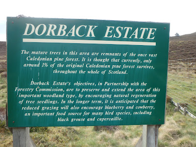 Preserving the mature trees remaining from the Caledonian Pine Forest
 Lots of mature trees...
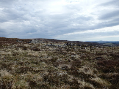
 The circle of shooting butts suggests there was once a duck pond here...


 Another view of my favourite hill, Meall a Bhuachaille


 And so the fordings of the Burn of Brown begins


 After the last fording, uphill through the trees
 View looking north along Glen Brown


 Must ignore the track to the left...


 Old Bridge of Avon


 Rabbit city, did anyone else notice there were so many rabbits around this year?

 Along Glen Avon
 Towards Tomintoul

NJ 170 184
I was awake early. I had listened to the wind blowing in the tops of the trees around me during the evening, but only the occasional strong gust had rattled the tent and I was well pleased with the sheltered spot I had found. I had to visit the en suite quite early and found the wind had dropped and now it was dead calm. I snuggled back into my sleeping bed, but was now wide awake. After a while, I decided I should just get up. I didn't actually check the time and I didn't particularly hurry, but as I picked up my pack ready to walk, I discovered it was 07:00. A tad early perhaps, considering the short day ahead, but I was ready to go so set off.
I took the path between the trees that led to the ford, the burn was running low as most others had been thus far, other than on day one. Once across, the path continued through woodland, winding through trees and shrubs alongside a burn, then out into open ground before another strip of woodland before passing under Eag Mhor and into the Braes of Abernethy. I was thoroughly enjoying walking this path, it was delightful. I was now on open farm land and had to cross the Dorback Burn, but again managed to cross dry shod. There were several old signs along the way, marking the route between Glenmore via Eag Mhor to Dorback. I eventually gained the road and headed for the Lodge, where a helpful sign pointed me to Tomintoul. I was heading for Glen Brown and knew the surroundings were going to change and have a deserted, unloved feel.


I met another Challenger by one of the many ruins, Stuart, maybe, but he was struggling with his arthritis and didn't want any company, so I strolled on. Soon the Burn of Brown came into view, with another helpful sign. I lost count of how many times I crossed the burn, I could perhaps have stayed on one side if I'd wanted, beside the forestry, but it was dark by the trees and I was still managing to cross dry shod, so I continued. Eventually I made the final crossing after spotting a gate that betrayed the hidden track I was after which would take me uphill and briefly into the trees and out again before heading downhill again and towards Kilnadrochit Lodge. There are good views along the glen from the highest point of the track, from which you can see seven abandoned and ruined crofts, quite sad.
I've walked this way before and had to ignore a nice path that went off to my right to eventually meet the road and cross the old Bridge of Avon to reach the picnic tables. It was only 11:00 when I arrived so I decided to take a long break here, as I couldn't book in to the Smugglers Hostel 16:00. I had time to kill. I sat and took my boots off. I ate my remaining cheese and tomato roll, crisps and a bar of chocolate. I wondered if I might have a signal and on checking, discovered I had a good 4G signal. I was delighted when I checked my emails to discover one from the hostel giving me the passcode and allowing me access. I packed away my belongings, put my boots back on and set off to walk the last 2km into the village. I arrived at the hostel by 12:30 and let myself in. I had a little look around before finding my room and going to take a shower. I left my things neatly by my bed and left the hostel to go and do my shopping in the Village Post Office and Store. On my way, I spotted Stuart and stopped for a chat. He was preparing parcels to send home of extra items he didn't need. In the shop I dithered over what supplies I needed and what I could find that I liked. It was tricky. After quite some time I made my purchases, withdrew some cash from the post office and returned to speak to Stuart. I'd decided to go for a cup of tea and he said he might join me.


I went to The Old Fire Station and settled for a cheese scone and a cup of tea, neither were great, but it was still nice to sit at a table indoors. Stuart came to join me and ordered and bacon roll. It came in a crusty baton, which I thought odd, but it wasn't mine, so I didn't care. My phone rang, which is unusual, and I chose to answer it. It was the warden of the hostel, "Louise, have you arrived?" Well, yes, you could say that! He just wanted me to pay so he could get on with other things, so I left Stuart to his odd butty and went to meet the warden.
Kenny, the warden, was lovely. He welcomed me to the hostel and showed me around, including how to use the washing machine and tumble dryer which were free to use. i paid and then I was left to enjoy the hostel, which at that point I was to have to myself. David was coming to take me out for dinner later, so I busied myself sorting out my pack and my shopping ready for the next day. As I was relaxing in the communal area, I heard someone trying the door to the hostel. I went out to find Kirsten who was looking to stay in the camping area. She spoke to Kenny on the phone and her stay was sorted. Meanwhile, David arrived and I almost ran to meet him, I suddenly realised how much I'd been missing him. We went to the Glenavon Hotel for dinner and had a lovely time. I think David may have been a little surprised by how hungry I was and that I ate a three course meal. I am not known for my ability to eat on the Challenge, this year I seem to have got it right!
After dinner, David came back to the hostel with me and we chatted a while until it was time for him to leave, he had an exciting errand to run the next day. We said goodbye and I waved him off. Kirsten came in for another chat, and I discovered we had another guest at the hostel, a young German chap.
I went to bed early and dozed as Sir Ian read to me.

Day 9 Tomintoul to Delavine
Planned 24 km 700 m ascent
Tomintoul to A939
Tomintoul to A939
Actual 26.76 km 785 m ascent
NJ 280 068
NJ 311 037 (or there abouts)
Initially the path was great. I remembered there was mention of landslips, but the signs I found were not terrifying and were easily avoided, or else a sheep trod worn across that was good enough for me to follow. All was going swimmingly. I even saw a Golden Eagle. The path eventually reaches the confluence of several burns and I whipped out my map and compass to identify the correct spur to climb as the path became indistinct at this point. The way ahead was steep, wet and slimy and somewhat fun to climb, but I eventually reached the top of the slope and checked my location. I was not convinced I was in the right place, but I could see the top of crag, The Eag ahead of me and the path should run along the top of it, so decided to just head that way in the hope that I'd find the path as I went. The heather was knee deep and made for difficult walking, not to mention wet. I decided to ditch the plan for bagging the trig and that I would just follow the path over the bealach and pick up the track on the south of the River Don. As I got closer to the crags, I could see a way down below the crags and a clear trod through the grass at the bottom. This was somehow more appealing than following the path along the edge of the crags. This was the best point at which to make my way down, decision time. Down I went.
NJ 280 068
NJ 311 037 (or there abouts)
I woke early and tried to get myself up and organised without disturbing the chap in the bunk room next to mine. I ate my breakfast in the communal area and remembered to take my cheese rolls out of the fridge. It was raining, I tried to leave as late as possible in the hope it would stop, but it didn't look like it will, so I left by 08:45 fully clad in waterproofs and headed towards Delnabo and followed the River Avon south. My route sheet said I was going to leave the road at Birchfield and take the track heading for Carn Breac then head for Tolm Buirich before joining the track west of Carn Ealasaid and heading south to the River Don. Instead, given the weather was miserable, I decided I could tick a trig instead on Craig Veann instead, which would require less time high and off piste, so I stayed on the track to just north of Dalestie before going through a gate in the deer fence and taking the track beside the Burn of Little Fergie. Of course, this meant I was following a path which I had vaguely researched some time ago and had no up to date information nor real memory of details. A little adventure, if you will.
 Random bench
 The view from the bench
 The crystal clear River Avon, somewhat bouncing along today


Initially the path was great. I remembered there was mention of landslips, but the signs I found were not terrifying and were easily avoided, or else a sheep trod worn across that was good enough for me to follow. All was going swimmingly. I even saw a Golden Eagle. The path eventually reaches the confluence of several burns and I whipped out my map and compass to identify the correct spur to climb as the path became indistinct at this point. The way ahead was steep, wet and slimy and somewhat fun to climb, but I eventually reached the top of the slope and checked my location. I was not convinced I was in the right place, but I could see the top of crag, The Eag ahead of me and the path should run along the top of it, so decided to just head that way in the hope that I'd find the path as I went. The heather was knee deep and made for difficult walking, not to mention wet. I decided to ditch the plan for bagging the trig and that I would just follow the path over the bealach and pick up the track on the south of the River Don. As I got closer to the crags, I could see a way down below the crags and a clear trod through the grass at the bottom. This was somehow more appealing than following the path along the edge of the crags. This was the best point at which to make my way down, decision time. Down I went.
The trod through the steep sided gorge was over lovely ground, pleasant respite from the deep heather I had been wading through. I looked up to the crags and watched a Peregrine Falcon fly away from the cliff. Wonderful. The path was clear all the way to the boggy end, in the middle of which was a beautifully made stile with added protection from the electric fence. In normal conditions, I would have had to wade through deep, wet peat to be able to use it, given the dry conditions of late, up until today in fact, it was easy to reach and climb, if a little wetter over the other side. There were footprints around here, but the disappeared, along with the path and I had make the best way forward that I could. The heather was mainly shorter than it had been previously and I was able to make good progress and join the track. I came to a bridge over Allt Tuileach where I stopped for a break. I watched brown trout leaping to catch flies in the pool in front of me, whilst behind me a Short Eared Owl was quartering the moorland, hunting.
I began to feel a bit chilled, so started walking again, still thoroughly enjoying my route, even in the wet. Which was good because within a kilometre, I made a howler. The locked bothy at Inchmore was as expected, but the lack of or change in appearance of the surrounding forestry threw me completely and I promptly wandered away from the obvious track and a bridge in search of another. I was quite clearly on some sort of a headland, with no way ahead other than down a precipitous cliff edge. Then I noticed the tree stumps of the obviously clear-felled forestry. Turn around Louise! Take the track and cross the bridge. Having said that, if I had not detoured slightly, I would not have found the dead juvenile Adder.
 The new jacket, beading well
 A delightful little glen, the Burn of Little Fergie


 Approaching the confluence
 Meur Cul na h-Eige, in case you were wondering
 Steep slimy slope
 The grassy trod below The Eag
 As The Eag opens up
 The crags above
 Excellent stile in the middle of a bog
 Hunt the path
 Bum shaped rocks in the wall, moorland behind where the Short Eared Owl was hunting
 Bridge over Allt Tuileach
 The pool with leaping brown trout
 Dead juvenile Adder, boot for scale


Below me on the track I was now heading for was another walker with a pack just big enough to be the pack of a Challenger, but instead of trying to attract their attention I tiptoed along the track above them so as to not attract their attention and derision.
Whoever they were, they were fleet of foot and I never caught them up although I did see them ahead of me briefly as they rounded the bend before Badochurn, but never saw them again. I trudged on.
At Cockbridge, I had to walk a kilometre along the road which I did as quickly and carefully as I could, the A939 is a busy road. I was soon at the turn off signposted for General Wade's Military Road, somewhere along which I was planning to camp. There were two or three properties to pass, which always makes me a little uncomfortable as I'm heading in to my camp as I don't like to announce my presence unnecessarily. Dogs barking as I trundle passed is not helpful. The first possible pitch I came to was the first General Wade's Bridge, not far passed the last property and there was very obvious evidence that dogs were frequently walked here. There was a nice grassy patch if it had not been for the doggy evidence, so after pondering I opted to walk on.
I continued along the track for a while and just as the second bridge hove into view, I could also see a building that could possibly be inhabited, Delavine according to the map. As luck would have it, the bridge was hidden from view by a small rise, so I was quite happy nobody would be aware of my presence. The second bridge was a far nicer option than the first, so that was where I pitched. As luck would have it, it had stopped raining shortly before I'd found my pitch, so I collected water and dived into my tent after removing my waterproofs which were now all but dry. My over trousers stayed in the porch but my jacket was dry enough to come inside the tent and benefit from a little warmth. I was a bit slow getting my dinner sorted as I'd made camp by 16:00, I did a little pampering and changed in to my warm, dry evening wear and snuggled inside a while to rest. Whilst pitching I'd noticed I had a clear view of the aerial on Hill of Allargue, thus I had an excellent 4G signal on my phone. I briefly browsed the internet and Amazon before messaging David. He had been successful in his special errand and we were now the proud owners of a small campervan, Ellie! I couldn't resist telling him that he was just over an hour away from where I was pitched, it would take me about the same time to pack up and walk out to meet him, so he popped to Tesco for supplies and threw his sleeping mat and bag in to Ellie whilst I struck camp and high tailed it out to the road. I had been hearing strange noises as I was relaxing in my tent, as I rounded a corner in the track I discovered what was probably making all the noise, a mini digger! I passed the third bridge on the track and the one I had pitched by had definitely been the best of them, but I was happy to be heading to the road to meet David and Ellie. A pleasant warm and dry evening was spent with them both.
 Corgaff Castle
 The first bridge and least attractive campsite
 The second and most attractive campsite

 My view, there's a mast over there somewhere
 I opted to cross the bridge rather than ford the Delavine Burn


 The last bridge, no easy pitch

Gin and tonic and profiteroles, what more could a girl want?


Gin and tonic and profiteroles, what more could a girl want?
Day 10 Delavine to Ballater
Planned 17 km 550 m ascent
A939 to Ballater
A939 to Ballater
Actual 16.3 km 483 m ascent
NO 369 952
 Waving bye bye to Ian and his motor home
 Ian's motor home, far below now, just left of centre


 Another one of those 'improved' tracks, uncomfortable under foot
 Glenfenzie ruins
 There's a track over that side

NO 369 952
I may have a bit of a lie-in, but to be far, I was planning to have tea and biscuits shortly with a very nice man, so I didn't want an early start. Having packed my pack I stepped out of Ellie to meet Stan Appleton exiting the General Wade's Military Road just as I had done the night before. I greeted him warmly, said my farewells to David and Ellie and encouraged Stan to join me for the short road walk (on the wrong side of the road? What possessed me?!) to meet Ian. At his motor home we found he was entertaining David Hardy and his walking companions Martin and Aileen, but they were ready to leave and make way for the new comers and we soon had seats and steaming mugs of tea. Ian handed me a bag containing a chocolate twist and although he'd bought it for me, I thought it rude not to share it with Stan. There was also Border's Dark Chocolate Ginger biscuits and I felt compelled to eat at least one. I have no idea why I exercised restraint. It was nearly 11:00 and Stan had been gone some time before I thought I should make a move. I didn't have far to go to Ballater today so was in no hurry.
I said farewell to Ian, crossed the road and took the track that headed steeply uphill. Steeply, always steeply! I realised I didn't need to reach Scraulac before heading off to gain the path, especially as the ground was really good going. There was fence to climb but it was an easy one and I took a bearing and just contoured the hill to meet the track. For a while, I was making good progress. I reached the ruined buildings of Glenfenzie and chose to follow the fence line for a while rather than the track, but soon found a gap in the wall and continued along it, uphill. Of course. I was looking for a path off to my right, but it wasn't clear. The path I took left the track at the same point but was heading off uphill to Lary Hill, not downhill to then contour it. Again, I took a bearing and then carefully made my way in the right direction avoiding some difficult, steep and rough ground. After a while, I noticed occasional lines of rocks that looked as if they were placed to mark a route, they were in the right general direction so I followed them. Just before the buildings at Inverenzie I spotted a very definite track below me, so cut down the hill to meet it, it lead to Lary where I took the road to Ballater. There were two people behind me with large packs, possibly Challengers, but I continued. I met another walker, but he was out for a day walk and was in a hurry. Along the road in Glen Gairn, I met another Challenger, resting by the side of the road, old friend Ray Disson! It was lovely to have a good catch up with Ray as I hadn't seen him for a while and he had had a few health issues. He's looking well and working on his fitness.


Better going on this side
We made it into Ballater just behind another Challenger, who I later realised was David Williams, I caught up with him later at the campsite. Ray had a B&B, so I left him to find his way there and made my way to book in at the campsite. I finally found out where the laundry is as I paid for my pitch, so I was quite quick to get pitched and get my shower so I could throw most of my clothes in the washing machine, of which there was only one working, and get them into the tumble dryer, of which there was only one, and there turned out to be a queue for it. Well, I would have pitched quickly, but got chatting to Barry, Jim and David, who was feasting on the contents of his enormous food bag. Barry gave me the news that Michael had been taken ill at Red Bothy. As luck would have it, Willem Fox was there, who is an experienced paramedic. He quickly diagnosed his condition and although help had already been sent for, he further alerted the rescuers to the seriousness of Michael's condition so the appropriate action could be taken. What a shame for their first Challenge to end so dramatically, but so lucky Willem was there. There were many others at Ballater, including Minna, Anna, Colin Ibbotson to name a few.
Alistair Pooler messaged to say he was on his way and he'd try not to be late, we had planned to eat together, which seems to be becoming a Challenge Tradition. In the end, he had to wait for me to fetch my dry washing from the laundry before heading to the pub, we arrived in time to order food and were able to get pudding as well. There were many more Challengers there, including the fabulous Humphrey Weightman. We had a really lovely evening, but both of us were tired and we were soon back at the campsite and heading for our tents.
Alistair Pooler messaged to say he was on his way and he'd try not to be late, we had planned to eat together, which seems to be becoming a Challenge Tradition. In the end, he had to wait for me to fetch my dry washing from the laundry before heading to the pub, we arrived in time to order food and were able to get pudding as well. There were many more Challengers there, including the fabulous Humphrey Weightman. We had a really lovely evening, but both of us were tired and we were soon back at the campsite and heading for our tents.
Things were going well and Sir Ian is the best.
Day 11 Ballater to Tarfside
Planned 27 km 1130 m ascent
Actual 27.5 km 1173 m ascent
FWA Ballater to Tarfside via shoulder of Mount Keen
Planned 27 km 960 m ascent
NO 491 798
 The new path beside the road
 Jim on his way to the Shiel of Glentanar

 Looking back down on Glentanar


 Looking north
 Looking east
 Looking west


NO 491 798
This was the first morning that I had woken up and felt that I really just could not be bothered. I have no idea why. All my enthusiasm and positivity had deserted me and I felt uncertain and doubtful, but with no good reason why. It was with huge effort that I propelled myself out of my tent and started to pack away. I made the mistake of having breakfast before finishing my packing and cursed as the rain started, quite heavily, and I had to pack away a wet tent. Not a happy bunny. I still managed to leave the campsite by about 07:50, which is another impressive start for me. I walked off in the rain along the road to Bridge of Muick. There has been a path put in which runs alongside the road for some of the way and these bits I walked.
I reached Bridge of Muick and continued on to Balintober. Here I met Jim, having a bit of a faff. I expected to continue alone, but we eventually ended up walking together. I've met Jim many times, but I don't think we've ever walked together. We chatted happily for most of the day, we may have been quieter as we reached our destination, but I learned a lot about Jim and his walking that I'd never known. We made steady progress to the Shiel of Glentanar where we caught up with walking orange rucksack covers we'd been following, carried by Christopher and Susan Marshall. There was also a solo lady Challenger ahead, but I'm not sure of her name, but it could have been Jennifer Adamson. We decided to have a short break despite the rain, I treated some water for an electrolytes drink, which also ensures I rest for at least twenty minutes. We eventually started the major uphill phase of the day. I was absolutely determined not to go round Mount Keen this time. It had been in my way twice before and this time I was going to the top. Jim had been intending to go round, but instead he decided to accompany me and I was absolutely delighted to have his company, it was very kind of him to change his plans. I have to say, he was an excellent walking partner as he set a brilliant, steady Alpine pace, one that we could maintain virtually all the way to the top. We stopped briefly to remove waterproofs in the hope that the rain wouldn't return until after we were over this hill, once to speak to the Marshalls again, once to speak to Jennifer and once to speak to the young men from Outdoor Access Trust for Scotland who were doing a fantastic job of repairing the path. I may also have paused briefly once or twice near the top as I just started to run out of breath. But oh my word I loved it, it was fantastic! I was so, so pleased to reach the top, which amused Jim no end. We didn't tarry long as it was a bit chilly, just took a few photographs and then made our way off the hill. The path down starts very nicely, but as you get further down towards the Ladder Burn, the track gets hard on the feet as the stones are large and loose. Anyway, we soon found ourselves at Glenmark where we found the driest ground we could on the gravel to have another sit down and a rest. I feared Jim was tiring now and his feet might be sore, but we didn't have far to go and I was still hoping I might get a bed at Tarfside, but we had no idea how busy it would be.


We were soon on our way again, through Glen Mark into Glen Esk, then we took the short cut north of Hill of Rowan. We had another short break on some convenient rocks, but were soon back walking and Tarfside hove into view. Eventually. It does seem to take a long time! We dropped our packs outside and removed our boots and I almost trotted into the kitchen to see some dear friends. Graeme and Marion Dunsire had finished their Challenge quickly this year so they could help at St Drostans and I was met with hugs from both. Next was Ann Thorn, her and Alvah were my first vetters and I always get hugs and a warm welcome from them both. I whispered to Ann, "Are there any beds?" "I think there might be.", she replied. "Alvah..." and there was!! Alvah got a big hug and a kiss and I may have done a little jig, I was so, so happy! I went straight back outside to rescue my pack and boots and pop them in to my room, just off the lounge, then returned to the kitchen to put my name down for a dinner and then I drank tea and ate cake and chatted with old friends and had a wonderful time.
I dragged myself away only to have a shower and to drag things out of my pack that needed airing, then I sat in the lounge and chatted with David Skipp, Julie Munkeby and Adrian Fortune, Paula and Steve Ruscoe and catching up with Mike's exploits since I last saw him at Cannich along with many others. I had a lovely evening meal followed by sleepy tea and another slice of cake. It was a quieter evening this year and when I went to bed, again quite early, I was not disturbed, although I must have been well hydrated. I'd gone from really not wanting to walk today to having an absolute ball, largely due to Jim's company followed by all the lovely people at Tarfside. Thanks all!

Day 12 Tarfside to Charr Bothy
Planned 20 km 830 m ascent
FWA Tarfside to Charr Bothy via The Retreat
Planned 16 km 410 m ascent
Actual 19 km 536 m ascent
NO 616 830
 Everyone else is headed over there somewhere, it's raining over there
 Tarfside is over there, somewhere
 In the direction of Mount Battock

 Mike's handy poo trowel
 The unnecessary ford


Actual 19 km 536 m ascent
NO 616 830
I had a short day planned for today, so although I was up at a good time, I was in no hurry to get on my way. I'd had a slightly restless night, my feet were hot and bit puffy and I'd been fretting about the Fetteresso Forest.
I joined a few people at the table, including Shap McDonnell. I had three mugs of tea before I was ready for my bacon roll. I chatted to Shap for a while, I haven't seen him for ages, and he was able to offer me some reassurance for my onward route through the Fetteresso. Brian on the Message Board had been offering news and advice about forestry works in the forest and to be honest I'd found it frustrating and confusing more than enlightening. Shap was really helpful and encouraging, I felt much better after our chat. I paid my bill then packed everything except my tent, which I put outside as it had stopped raining in the hope it might dry off a bit. I returned to the table to enjoy the company of St Drostans, and soon other Challengers began to pour, almost literally in some cases, from the hills. The Pieman and son James had had to exit their camp at the Water of Unich somewhat hastily at dawn as the waters rose unnervingly around them after heavy rain during the night. They were followed by Nicole, Bernie, Mike Barras, Nik Lawcock and Lynn Robinson and a few others. In the meantime, I had consumed two more cups of tea and three more pieces of cake. It was time to leave! My feet had been quite tired and sore after our walk in from Ballater, so I decided to take the easier option (or so I thought) of the lower level walk along the road to Milden Lodge and then up into the hills to Charr Bothy.
The walk along the road was quite quiet and I made Milden in good time. Through a gate and up around the corner I found a flock of sheep, but not just any sheep, sheep with large, curled horns. They may have all been tups, they were quite chunky and a little bolshie. I kept an eye on them as I beat a hasty retreat uphill to the gate. Once through, I pottered along again, enjoying the views. An estate truck came through a gate ahead of me and the driver waved cheerily as he passed me by. I went through the gate and continued on my way. All was going well until the track beside Burn of Leuchary. I struggled to make sense of the track on the ground, what was marked on the map and where my compass said I should be heading. As luck would have it, I saw a figure behind me that I guessed was Mike Barras who I knew was going my way, so I waited for him so that we could collaborate, it's always good to ask a friend. Whilst I loitered, I watched a Red Kite being mobbed by smaller birds, possibly Meadow Pipets.


North Water Bridge is over there, somewhere
Mike caught me up and agreed that nothing was as it should be. He also agreed that the best course of action, which I was intending to take had he not appeared, was to follow a vague trod alongside the fence line to gain a view down the other side of Stobie Hillock which might shed some light on our route forward. Off we went, chatting as we went as we'd not met before this morning, but we live within about 25 miles of each other. At the top we had to climb a fence that was potentially electrified, but did not prove to be too difficult, then we had some heather and peat hags to negotiate on a slightly steep ground to gain the track we could now see ahead of us. We also had a boots off crossing in the way, but this was no problem. There were a further two crossings, at least one was boots off, before Mike reached his pitch, near an unusual sheep fold with an enormous poo trowel. I bid him farewell and metres further on had another boots off crossing that I wouldn't have needed to make if I had circumnavigated the the previous one. Drat. There were another two boots off crossings, two I managed dry shod and a bridge before I finally made it to Charr Bothy. On my way I was passed by two estate vehicles, one of them twice and carrying a rifle case, presumably containing a rifle. I was casting around for somewhere to pitch when I suddenly spotted a tent by the river. It looked suspiciously like Jim's. I found another tent with its owner, John, who confirmed Jim was here and said I was welcome to pitch there too, although he did offer me pitches further away a couple of times. I eventually found a reasonable spot near Jim's tent. After much faffing, I took my dinner and Flash up to the bothy, where I also found Robert Fay.


Hmm
We had a quiet start to the evening as we all prepared and ate our meals, then Robert insisted we played Top Bothy. Jim and I weren't initially keen, but I have to say we did have a laugh. John shared some whiskyk, but I wasn't able to join them. I decided to go back to my tent before it got dark so that I could find a reasonable en suite. Handy really, I found I was quite well hydrated again in the night, must have been all that tea.
A pleasant day, Sir Ian was fabulous as usual.
Nearly. There.
Nearly. There.


Day 13 Charr Bothy to Cowie Water
Planned 24 km 1000 m ascent
FWA Charr Bothy to Cowie Water avoiding Clachnaben
Planned 21 km 700 m ascent
Actual 35.5 km 612 m ascent
Charr Bothy to Stonehaven
 The last snack

 Waiting for Alistair
 On the corner
 Can you see him?
 Getting closer
 Closer
 Alistair!!
 Toes in the sea!!

Actual 35.5 km 612 m ascent
Charr Bothy to Stonehaven
I had nightmares in the night, someone was trying to get into my tent, I hoped Jim was sleeping deaf ear up so I didn't wake him when I screamed.
I was awake early, but got off to a slow start and yet again too slow to avoid packing away a wet tent. I made my way up to the bothy to have breakfast and Jim warned me as I walked in that we had company, in case I was cursing the weather and my stupidity. Mike had been taken ill in the night and had set off early, calling in to the bothy for a break. We were on our way by 08:45. We discussed which path to take, but shortly after passing the weir, Mike spotted we were headed over the hill rather than along the river. We took corrective action, there were signs that several other people had done the same thing. I think the confusion had been caused by what looked like a reservoir where I was only expecting a river. However, we were now correct and chatted as we walked until we reached the road. Here, we parted company with Mike, and much to Jim's delight he had another day to walk with me. We found the track we wanted into the forest and just trudged on through the rain. And boy did it rain. All. Day.
Rain like this doesn't just seep into your clothes (although I actually remained dry all day) and your pack, it affects your mood and state of mind. I think having a hood up for long periods of time doesn't help, it cuts you off from the world around you, even if you aren't alone. We seemed to trudge endlessly through the forestry, we didn't see another soul for hours. It was unfortunate that every time Jim got his compass out, we were heading N or NE, he was less than impressed. It took quite some time to reach the right turn before the left turn to enter the wind farm. When we did, it was vague and wet, but marked with Scot Way marker posts. I think the path thought it was a river bed. It was only a short while before we reached a major track and a left turn to take us through the wind farm. We very soon started to pick up Exit signs and decided to just follow them, as that was what we wanted to do after all. It was an eerie experience, but with hoods up and low cloud I don't think we got the full effect.
It did not take long to reach the other side and I was less than two kilometres to my planned camp. There was a water source near my turn off, but I just could not be bothered to stop and collect any, I did not fancy my camp at Leachie Hill and I decided to keep Jim company for the rest of the afternoon. Lucky Jim.
We trudged on. After another kilometre there was a break in the rain and we found ourselves a perch to take a rest. Of course, it started to rain. We sat, stubbornly, and had a snack and a drink. Two other Challengers had been sitting around the corner and said hello as they passed. Not long after, we followed them. It did not take long to reach the area I'd camped previously by the Cowie Water, but it was not inviting. The ground is tussocky, the grass was long and lush and wet and I just didn't want to stop there. There were other possibilities, but when we looked they did not meet my high standards. If I had not been there, Jim would happily have pitched on some neatly cropped grass under a low hanging branches. This did not appeal to me. We walked on. Just before Stonehouse, we took the path that Laura and I had chosen not to/ignored/missed last time that was quite a nice little path staying closer to the Cowie Water all the way to Mergie. We met three Challengers, a Canadian pair, Malcom Smith and Martha Wheaton, who had spoken to me at Tarfside (at least, I think that's who they were) and one of our European friends (apologies, a solo young lady, I have narrowed it down to three names...) (As you may have gathered, I've really struggled with names this year...) We chatted a while and discussed possible camping opportunities. We all walked on, but not quite together. Just as the path left the river, Jim suggested we should collect water as this was quite likely to be the last chance before we found a suitable camp. On we went, again meeting the two Challengers, (possibly Kate Kowalska and Saskia?) who pointed out we only had 10km to go. "10km" muttered Jim, "10km". It occurred to me we could walk to Stonehaven quite comfortably within two hours. No time at all.
There were not many camping opportunities in reality, perhaps only one that I could have been persuaded to try. There was another that the threesome chose to make stop at, the sign warning of Adders didn't put them off, but they did find out it was a tick fest. We walked on to a car park where we'd hoped there might be benches, maybe some grass we could pitch on, but it was not to be. We had a break anyway, Jim took out his stove and had soup, I had my last cheese roll, chocolate and poured away the water I had collected. We had by now decided we could make it to Stonehaven. I had a signal and had messaged David our plans, he thought it very wise given the forecast and offered to find me a room, I couldn't have replied more quickly.

All steamed up, but the sea was just over there!
We eventually set off again, I tried really, really hard not to speed up, but I have a really, really bad habit of doing just that. As we walked, Alistair got in touch to say he was walking into Stonehaven behind us, although he was at least planned to be. He was about 2km behind us and as he had a room booked at the same place that I now did, so poor Jim was abandoned at the junction at the cemetery and I waited for Alistair to catch me up. It didn't take long and we were soon marching in to town to reach the sea and dip our toes. I didn't make Dunnottar Castle, but I did make the sea on the east coast.


We both made it!!
Day 14 Cowie Water to Dunnottar Castle
Planned 17 km 280 m ascent
Actual Bus to Montrose!
Postscript
I had a wonderful Challenge this year, due to various factors.
Kit
I didn't make many changes this year. I took my new Rab Kinetic Alpine jacket instead of my Paramo, because it is much lighter and the forecast had been good before we left, I thought that if I was going to have to carry my jacket, I would rather it was lighter. During the second week when it rained considerably more, I found the Rab comfortable to wear and kept me surprisingly dry, although it did feel more chilly at times than my Paramo would have done. All in all, it performed well, better than I'd thought it would, it had been a bit of a risk.
I have a new pillow, an Exped Air Pillow UL. Works really well, my neck was happy.
I wore Rab Skyline Tights this year, extremely comfortable. They did go a little fuzzy on the seams when I'd been walking through deep heather, but that has settled down again since they've been washed.
I took electrolyte tablets with me this year to try to stay hydrated. This worked really well and I found I drank much more than usual and my appetite was much improved. I had Berroca tablets with my too, for an alternative flavoured drink.
I was taking part in some research and part of this was to carry a Garmin inReach device and use an app on my mobile to do some screen recordings. I loved being able to contact David and have two way messaging with him, anytime, anywhere, but whilst I enjoyed it and took full advantage of the opportunity, I still could not justify purchasing a unit just for use two weeks a year.
I used my mobile slightly differently this year. I have a widget on my Garmin watch which gives an accurate OS Grid Reference. I used this to check my location and then my map and compass to navigate, which I found really satisfying and thoroughly enjoyed. I still had my mobile on flight mode, with Viewranger tracking every day. Interestingly, when checking each days walk, the parts I'd felt I was probably off the path and tried to continue best I could with map and compass, the track on Viewranger shows me more or less exactly on the intended paths, which pleased me even more!
Injuries and pain
Few and little.
As happened last year my hips were bruised and grazed, but I think it is just unfortunately my shape. Since I've been home, I've come up with a possible solution. I'll experiment and let you know.
My feet did get tired and sore, particularly the day I walked from Ballater to Tarfside. I was glad to be able to give them a long rest by not leaving so early the next day for Charr and they recovered well. I have had no rubs or blisters and as I managed to control the puffiness, my feet haven't peeled this year. Delighted with that!
I did have some neck/shoulder pain, but only occasionally resorted to painkillers to control it.
On the Challenge I usually suffer knee and thigh pain. My right knee often hurts heading downhill at the end of the day, eases as I make camp and go about my chores, then once I'm in bed my outer thigh starts to hurt, often waking me or sometimes preventing me from going to sleep. I have found the only painkiller that gives any relief is paracetamol and codeine, I take one dose a day at night to help me sleep. This year, I had slight pain in my outer thigh and resorted to the tablets for the first two nights, but had no further bother. I was delighted with that and can only put it down to my improved fitness and strength. I will continue with the running!
The People
Can I just say, it's the people. It's the people during this event that make it so, so special. The Co-ordinators, the vetters, the volunteers at St Drostans, Emily, TGO magazine and the sponsors, all of you make this event possible and such a successful and incredible experience. Thank you.
This year was extraordinary and most humbling. I had so many new Challengers approach me, ask if I was "Louise on the Message Board" or "Louise with the blog", the answer to both was mostly a wary "Yes?", worrying what I'd said to upset, annoy or mislead. Apparently, I should have more faith. If I have inspired, helped or encouraged anyone in any way with my blog or any information I give on the board, I am happy to have helped. Please feel free to get in touch directly if there is anything I might be able to help with, I am more than happy to if I can.
I was delighted to see so many of my friends and to catch up with as many as I could. It was also lovely making new friends and hearing the stories of their adventures. I hope to see you all again somewhere on another Challenge. You were all wonderful, but especially those that I spent time walking with, putting up with my sense of humour, dreadful memory and often grumpy mood. Thank you for making the Challenge what it is, a unique, beautiful, inspirational and life changing experience.
6 comments:
Hi Louise, who exactly is this mysterious person Jim Anderson? No one on the challenge of that name. Have you been in the presence of a ghost? regards Jim
Hi Jim! Apologies, I have no idea why I keep getting your name wrong, Anderson just rolls off the tongue. Or maybe it's age related. Corrected now.
Good stuff Louise, and well done. It was great to see you at Ballater, albeit briefly.
Thank you David, it was lovely to see you too! Maybe get a longer chat next time. And there will be a next time 😁
Hi Louise,
great read as usual. I enjoyed walking with you but glad I turned off before your encounter with the bull! Your last section is very true.
Adrian.
Thank you Adrian! I was so miffed to be on my own at that point, typical!
The Challenge is all about the people, isn't it? Thank you for your company, and that idyllic pitch. See you again!
Louise
Post a Comment